Nationwide Solar Inspection Coverage
Serving utility-scale solar farms, commercial installations, and ground-mount systems across the United States with fast deployment and professional data collection.
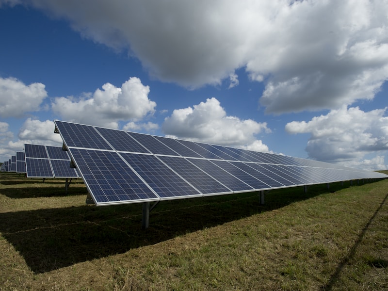
Thermal imaging and aerial documentation that identifies issues, supports warranty claims, and prevents costly downtime across utility-scale farms, commercial arrays, and ground-mount systems.

Large-scale installations with thousands of panels

Safe inspections without disrupting operations

Precision aerial mapping and thermal orthomosaics

Overhead assessments of parking structure systems
Comprehensive thermal analysis identifies defects before they impact your bottom line

Cell-level thermal anomalies and defects

Underperforming strings and connections

Thermal anomalies in inverters & combiners

Cracked cells and physical defects

Encroachment and shading issues

Dirt buildup affecting performance

Mounting and structural concerns

Electrical and conduit issues
Professional drone inspections tailored to your specific solar infrastructure
Complete thermal and RGB documentation for large-scale installations to identify performance issues and maximize energy yields across thousands of panels.

Safe inspections without disrupting operations or requiring roof access—ideal for facility managers and O&M teams managing commercial installations.
Precision aerial mapping and thermal orthomosaics for comprehensive system performance tracking and asset management integration.


Overhead thermal and visual assessments of parking structure solar systems with detailed structural analysis and safety evaluations.
We deliver inspection data in the format that works best for your team—whether that's raw imagery, processed maps, or integrated into your preferred platform.
Georeferenced thermal and high-resolution RGB orthomosaic maps with precise temperature data and panel-level GPS coordinates for seamless integration into asset management systems.
View SampleComprehensive reports in your preferred format with identified anomalies, severity classifications, GPS locations, and actionable recommendations for maintenance teams.
View SampleComplete access to all raw thermal and RGB imagery and video footage for internal analysis, warranty claims documentation, or third-party processing.
View SampleData uploaded directly to DroneDeploy platform for collaborative workflows, annotation tools, and streamlined sharing with your O&M teams and stakeholders.
View SampleProfessional data collection with fast turnaround and personalized service—not a faceless nationwide network
All pilots are FAA Part 107 certified, fully insured, and trained in thermal imaging best practices for accurate solar inspections.
Rapid data delivery after flight completion—critical for time-sensitive warranty claims and O&M decisions.
DJI Matrice 4T and 30T drones with high-resolution thermal cameras and 48MP RGB cameras for comprehensive inspections.
Your data, your way—raw files, processed maps, platform integration, or custom formats based on your operational needs.
Work directly with your pilot and project manager—no middlemen, no delays, just clear communication and accountability.
Professional service without enterprise overhead—transparent pricing and fast quotes for single sites or portfolio-wide inspections.
Quick answers to common questions about our solar inspection services
Inspection time depends on the size of your installation. We'll provide an accurate timeline during the quoting process.
We need clear skies, low wind conditions, and panels actively generating power for accurate thermal data collection.
Our thermal imaging identifies most common issues including hotspots, string failures, panel damage, soiling patterns, and electrical anomalies.
We deliver data in formats compatible with DroneDeploy, Raptor Maps, and provide raw data in standard formats like GeoTIFF, shapefile, and CSV.
Yes. We provide comprehensive documentation including thermal imagery, temperature readings, GPS coordinates, and detailed reports that meet manufacturer requirements.

Serving utility-scale solar farms, commercial installations, and ground-mount systems across the United States with fast deployment and professional data collection.

Get professional thermal imaging and aerial documentation to identify issues, support warranty claims, and maximize energy production across your solar portfolio.
FAA-certified pilots • Fully insured • Fast turnaround • Nationwide service